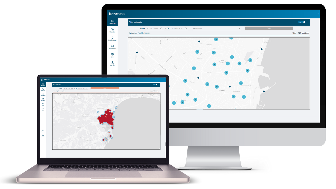
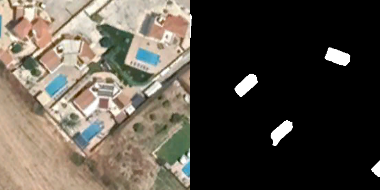
Our Swimming Pool detection service leverages advanced, state-of-the-art proprietary AI models and high spatial resolution satellite imagery to accurately identify swimming pools. Through this service, we empower municipalities, local authorities, and other organizations to access reliable data for better monitoring, decision-making, regulatory compliance, and resource planning.
Track changes over time with yearly comparisons
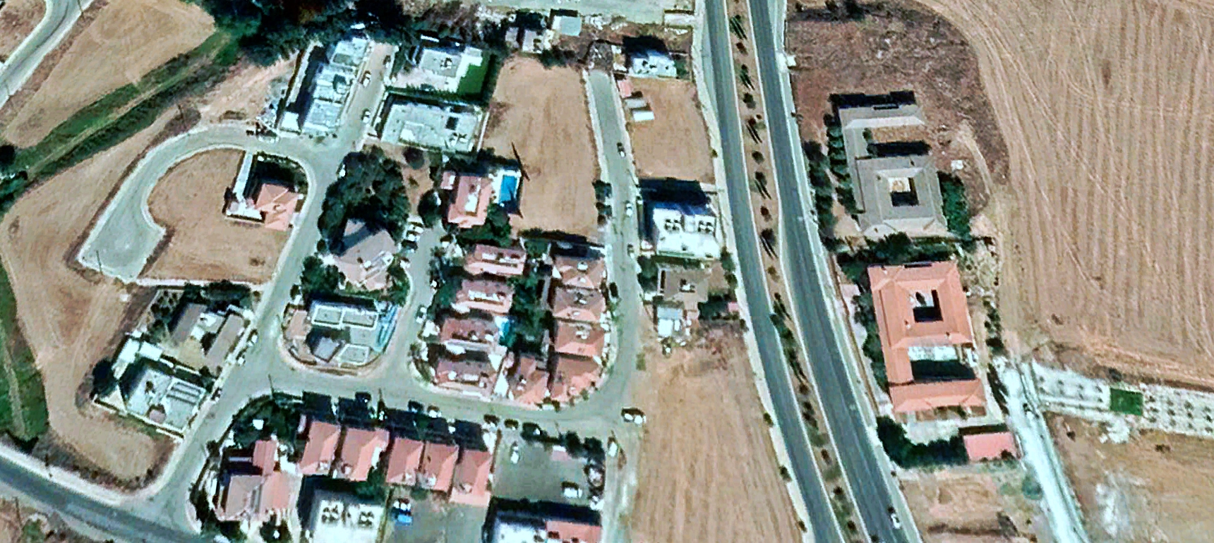
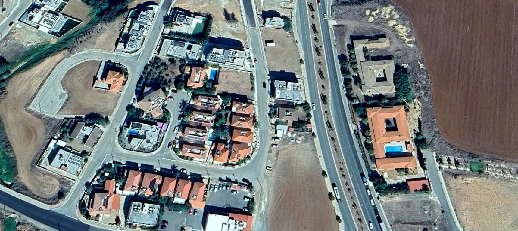
Monitor the development of new swimming pools in your area of interest across different years, identifying trends or new business opportunities.
Access analytics powered by emerging technologies
Satellite Imagery
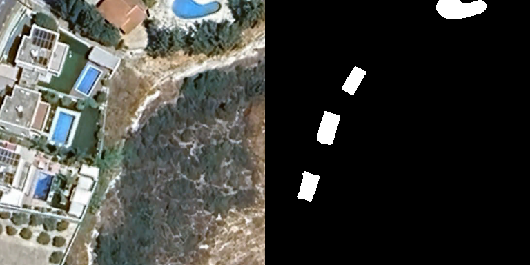
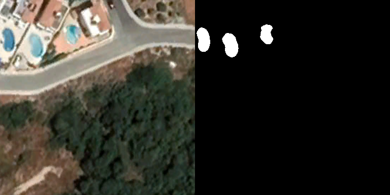
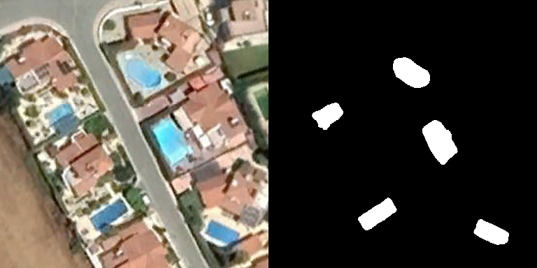
High spatial resolution satellite imagery, @0.3-0.5 meters/pixel, capable of identifying swimming pools regardless their size or shape.
Artificial Intelligence
Proprietary AI models trained on extensive datasets to detect swimming pools with high precision (85%) and recall (80%).
GIS-Based Portal
Access via the PERIOPSIS Portal, featuring a comprehensive interface for monitoring, visualizing and managing all assets.
Offered via the PERIOPSIS Portal
Easy on-boarding with predefined or manually drawn geographical zones and seamless access to all swimming pools’ insights via the PERIOPSIS Portal, without the need for specialized skills or knowledge.
FAQs
Our Swimming pool detection service can detect pools with high precision (85%) and recall (80%). You can check our blog where we describe our service and its overall performance. We consider our results as state-of-the-art, considering both research and commercial competition.
The frequency and timeframe of surveys depend on your needs and resources. We recommend annual surveys to cover tracking for taxation and billing purposes. More frequent updates can be scheduled for detection of newly constructed pools. One-off surveys can also cover planning and baselines for shorter projects. Surveys combining recent and historical data are recommended to identify trends in pool development activity.
Our models identify pool shapes but currently do not classify usage. For classification needs, please contact us at [email protected].
Yes, we use trusted third-party maps to provide the estimated address for each property with a detected pool. Address matching quality depends on local data availability and coverage, so results may vary by region.
Simply sign up on the PERIOPSIS Portal and submit a new project following the guided procedure. You can select an area of interest (AOI) manually by drawing a polygon or by selecting a predefined polygon, in case you represent a regional authority. We handle your personal information with the highest standards of security and privacy, in full compliance with the GDPR.
Yes, it is possible. Please contact us first at [email protected] so we can review your data. If you have imagery meeting our resolution and metadata requirements, we can run our models on it.
We currently fully support Cyprus and Greece. If your region is not supported but you still want to use our services, send us an email at [email protected].
This ranges between 15 and 30 days, depending on area size and weather (i.e., cloud) conditions.