Access insights powered by emerging technologies

Satellite Imagery
High spatial resolution satellite imagery, @0.3-0.5 meters/pixel, capable of identifying small-scale dumping sites (from 1m²) to larger landfills.

Artificial Intelligence
Proprietary AI models trained on extensive datasets to detect dumping with high precision (90%) and recall (85%) across diverse terrains.
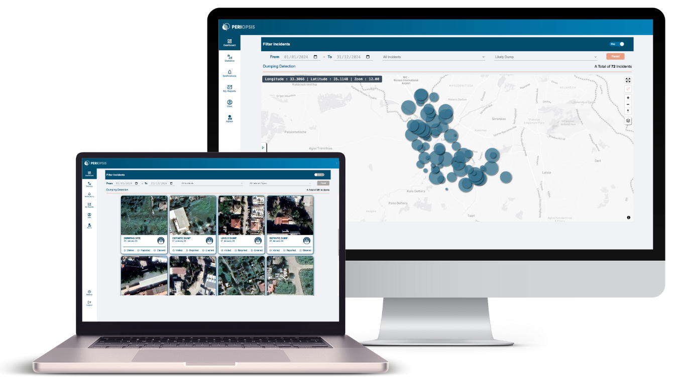
GIS-Based Portal
Access via the PERIOPSIS Portal, featuring a comprehensive interface for monitoring, visualizing, and managing illegal dumping data.
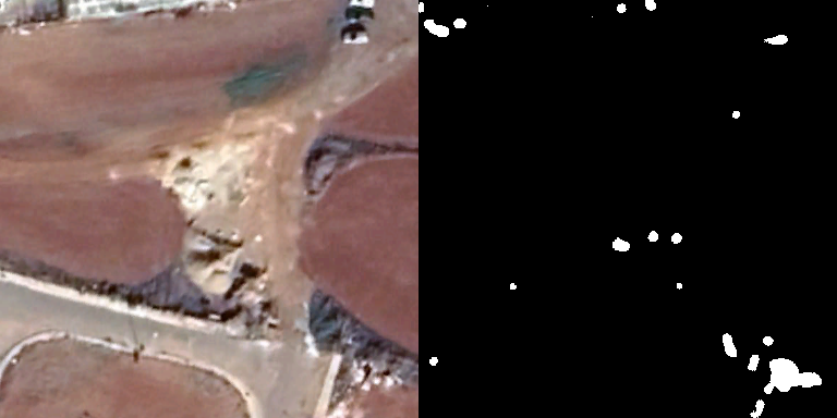
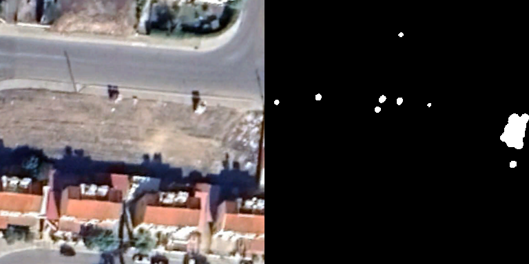
What does it detect?
Individual garbage/litter (1-2 m²)
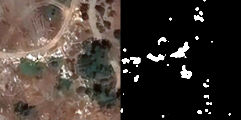
Stacks of garbage of different nature (2-9 m²)
Stacks of garbage of different nature (2-9 m²)

Landfills and garbage dumps (10+ m²)
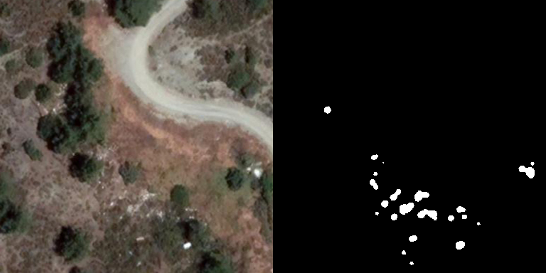
Individual garbage/litter (1-2 m²)
Offered via the PERIOPSIS Portal
Easy on-boarding with predefined geographical zones for all communities, municipalities and regions and seamless access to all illegal dumping incidents through our platform, without the need for specialized skills or knowledge.
Trusted by municipalities and national authorities


Benefits

Surveillance within your area of interest without the need for on-site inspection, reduced and targeted routes for dumping collection with an impact on staff efficiency and workload.
Access analytical data and statistics on dumping such as monthly and annual trends and data analysis and in the form of hotspots, charts, incident history visualizations and more.
Assign the cleaning of a specific dumping incident to a specific person or department and monitor the cleaning efforts in your area of interest.

Add your team to the PERIOPSIS Portal and take advantage of the variety of tools to efficiently coordinate the cleanup efforts in your area of interest.