Illegal fishing is not only decimating marine ecosystems but also wreaking havoc on legitimate fishing industries and coastal communities around the world. The environmental and economic toll is mounting, with experts warning that without stronger monitoring systems, the damage could become irreversible.
According to recent studies, illegal, unreported, and unregulated (IUU) fishing contributes significantly to global overfishing, disrupting food chains, depleting endangered species, and destroying fragile habitats such as coral reefs. Beyond the ecological damage, the practice creates unfair competition, undercutting law-abiding fishers and forcing some to risk engaging in illicit activity just to stay afloat.
The implications stretch even further. Illegal fishing has been increasingly linked to organized crime, human trafficking, and labor abuses. It also poses a growing threat to global food security, particularly in developing regions that depend heavily on marine resources for protein and livelihoods.
Yet illegal fishing is not the only maritime issue raising alarms. In early 2024, Cyprus reported a surge in unauthorized sea crossings, particularly from Lebanon, as individuals fled conflict and economic hardship. These dangerous journeys underscore the urgent need for more effective maritime monitoring — not only to track vessels engaged in illegal activities, but also to save lives.
Improving maritime surveillance is critical on multiple fronts. Fortunately, emerging technologies are offering new hope.
Modern systems such as the Automatic Identification System (AIS) enable real-time vessel tracking, while advances in satellite imaging — particularly Synthetic Aperture Radar (SAR) and high-resolution optical sensors — allow authorities to monitor even the most remote regions of the world’s oceans. SAR provides 24/7 monitoring regardless of weather, and optical satellites deliver sharp images that can reveal vessel types and sizes. When combined with artificial intelligence, these systems can scan vast ocean areas daily, detect vessels with high accuracy, and identify suspicious behavior, such as ships disabling their AIS to avoid detection.
Recognizing the power of these tools, our Research Department recently concluded a project that combines satellite imagery with AIS data using proprietary deep learning models. The goal: to detect unauthorized vessels and enhance maritime situational awareness around Cyprus and beyond.
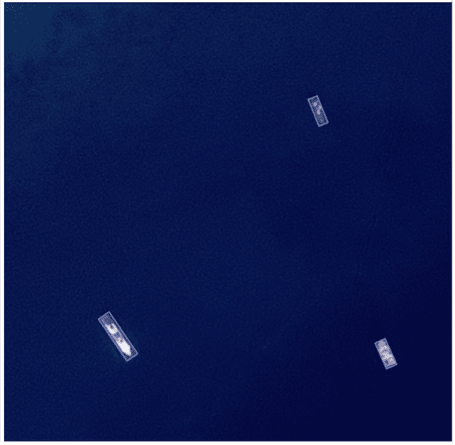
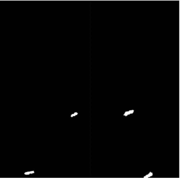
The system integrates two AI models — one for visible satellite imagery and another for SAR. These models achieved impressive F1-scores of 94.8% (optical) and 99.1% (SAR), indicating high precision in vessel detection. Some images of detected ships are provided below, based on visible imagery (left) and SAR imagery (right):
| Visible (Optical) | SAR |
|---|---|
 |
 |
Researchers were also able to estimate vessel size and classify ships into categories such as tankers (100–300m), passenger ferries (60–200m), fishing boats (10–60m), and pleasure craft (5–40m). We summarize this classification scheme below, showing an example of a representative detected ship at each category:
| Classification | Length range | Example image |
|---|---|---|
| Tanker | 100 – 300 meters | 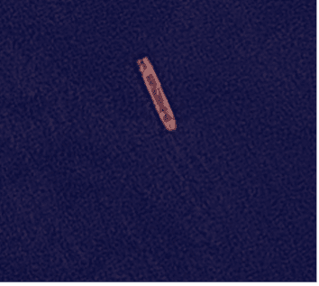 |
| Passenger/Commuting | 60 – 200 meters | 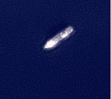 |
| Fishing boat | 10 – 60 meters | 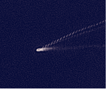 |
| Pleasure craft | 5 – 40 meters |  |
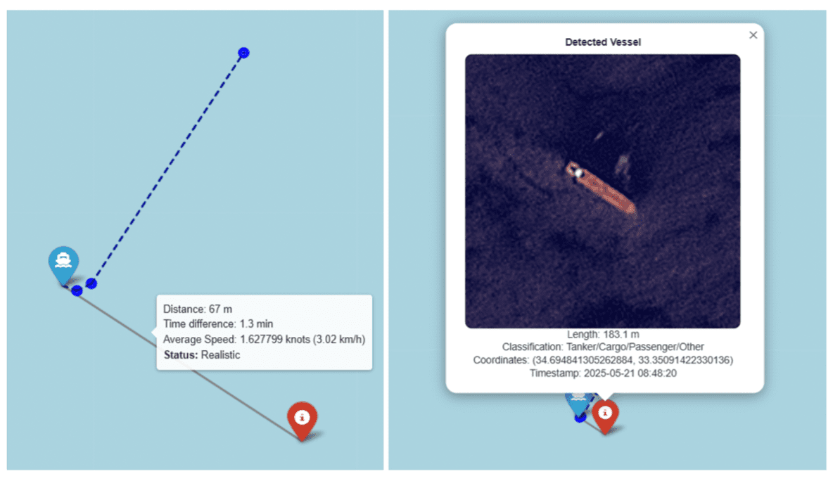
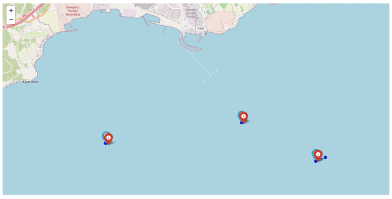
Detected ships were geolocated using satellite metadata and matched with AIS data through Kalman filtering, allowing analysts to determine ship identity, speed, and route history.
Images captured during the study show both detected ships and their corresponding AIS tracks near the port of Limassol, highlighting the potential for these tools to support enforcement, search and rescue operations, and national security.
 |
 |
As illegal fishing and unauthorized migration continue to challenge Mediterranean waters, integrating AI, satellite imagery, and global data systems could be the key to turning the tide.