Satellite monitoring reveals recurring vessel activity across three of Cyprus’s marine protected areas
More than two thousand detections at Lady’s Mile, Latsi-Akamas and Cavo Greco within the months of June-August highlight distinct activity patterns and the value of stronger observation in sensitive coastal waters.
Satellite observations recorded 2,060 vessel detections across Lady’s Mile, Latsi-Akamas and Cavo Greco during selected summer periods in 2024 and 2025, providing a new perspective on the environmental disturbances inside three of Cyprus’s more important Marine Protected Areas (MPAs).
These areas protect ecologically valuable coastal habitats, including Posidonia oceanica meadows, which provide important nursery and feeding grounds for marine species, support biodiversity, and contribute to coastal protection and carbon sequestration.
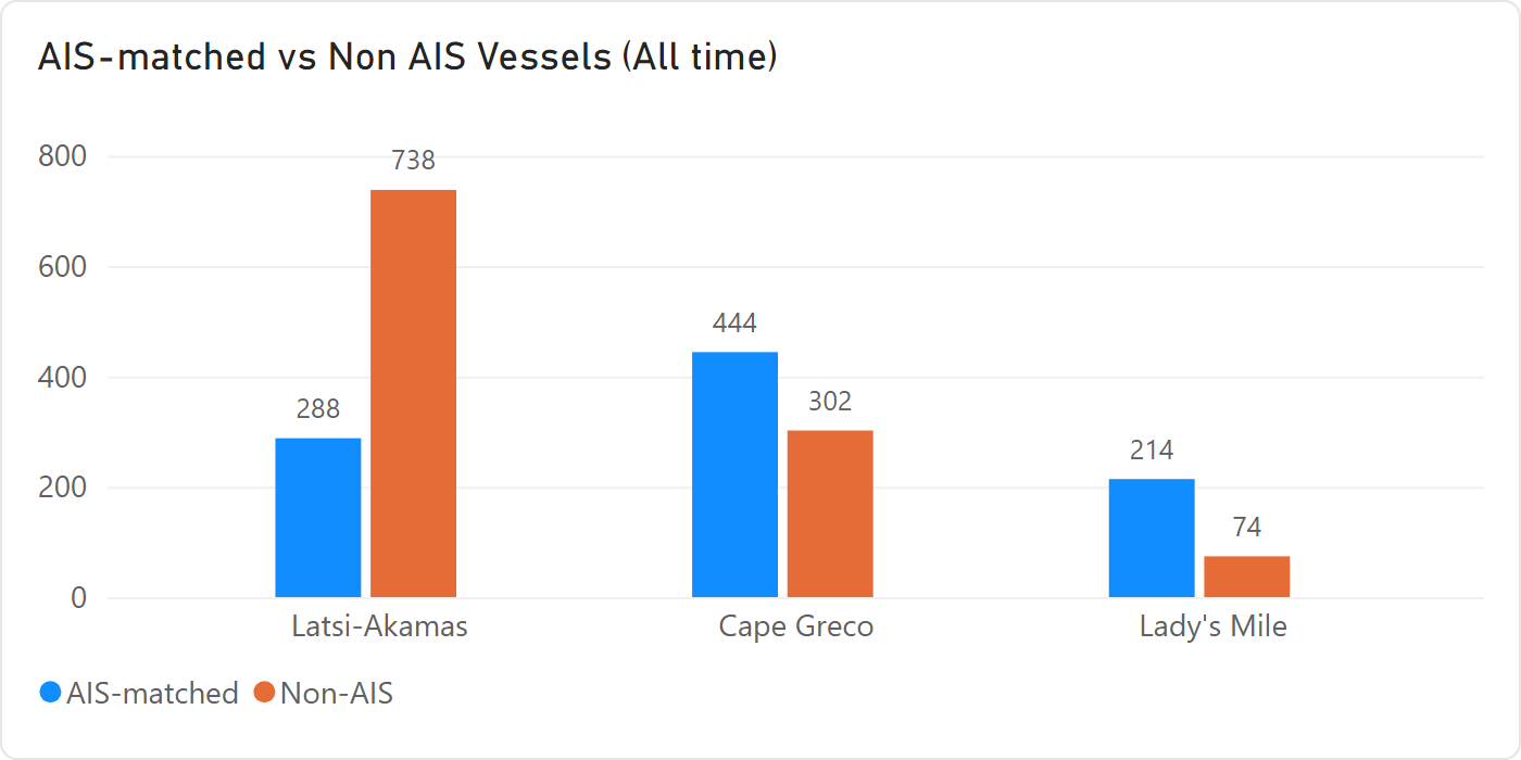
The analysis used the AI-empowered vessel detection service of PERIOPSIS LTD based on visible satellite imagery, to detect vessels at sea, comparing detections with the Automatic Identification System (AIS) data, a vessel-tracking system through which ships share information on their identity and journey. Of the 2,060 detections, 1,114 — about 54% — had no matching AIS signal in the available data, revealing a substantial visibility gap between what could be seen from space and what appeared in conventional tracking systems, emphasizing the importance of remote sensing in such surveys.
The satellite snapshots do not reconstruct complete vessel journeys, but they show repeated vessel presence and where activity clusters. As the analytics consider once-per-day passage of a satellite, the actual detections could be many more than those 2,060. Used alongside AIS and patrols, satellite monitoring can help build a fuller picture of activity in sensitive waters and identify persistent monitoring blind spots.
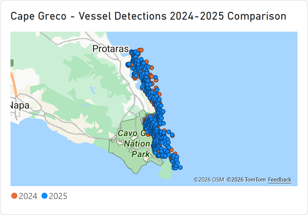
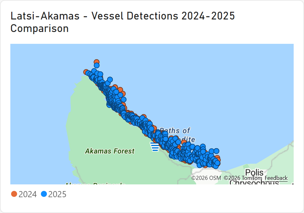
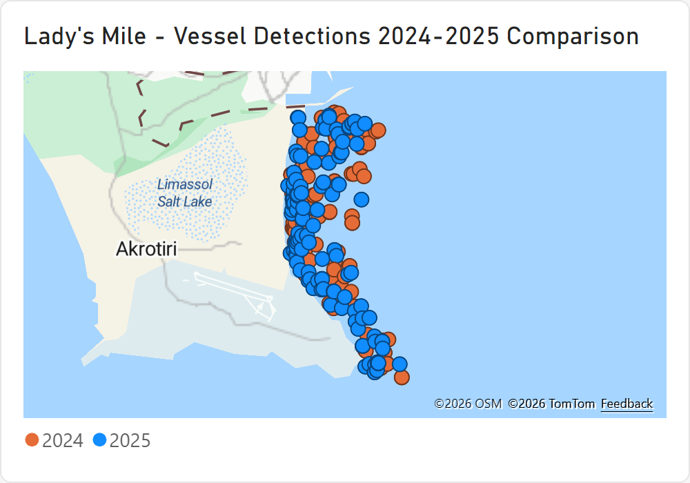
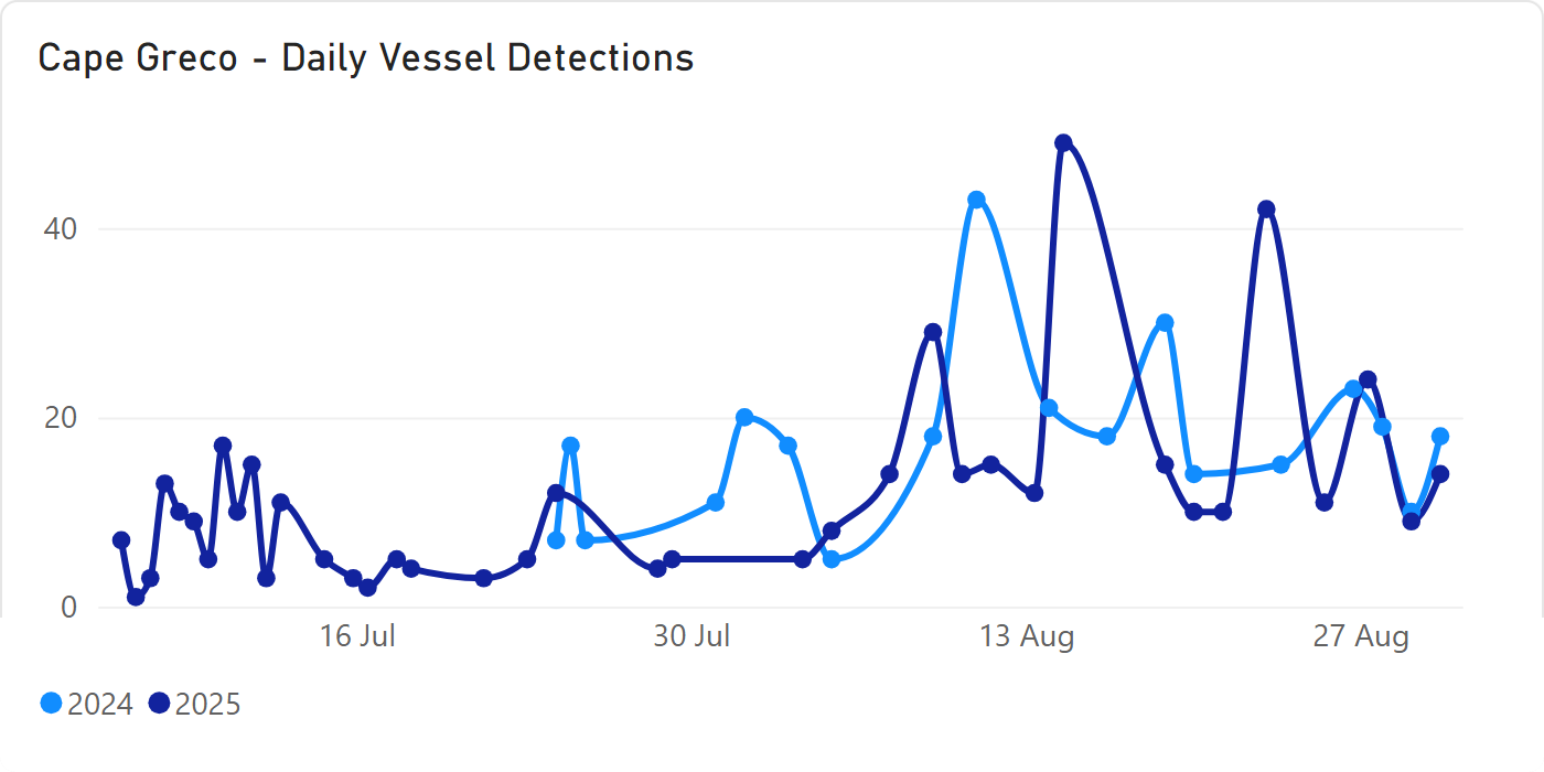
The Latsi-Akamas MPA was the most frequently visited of the three areas, accounting for almost half of all vessel detections and showing the highest activity on satellite observation days in both years. Latsi-Akamas recorded 1,026 detections, including 738 without an AIS match. Cavo Greco recorded 746 detections, of which 444 were AIS-matched and 302 unmatched. Lady’s Mile recorded 288 detections, with 214 matched and 74 unmatched. Unmatched detections may reflect legitimate tourism, recreational boating or other uses, but they can also point to unreported or potentially illegal activity at sea, including fishing, transportation of goods or other activities. The differences show why monitoring needs to be tailored to each protected area. Time series graphs indicate that July and August are busier months than June.
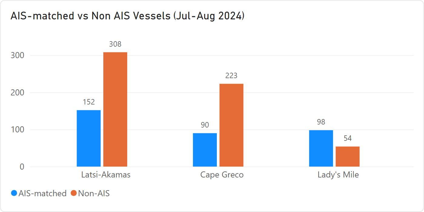
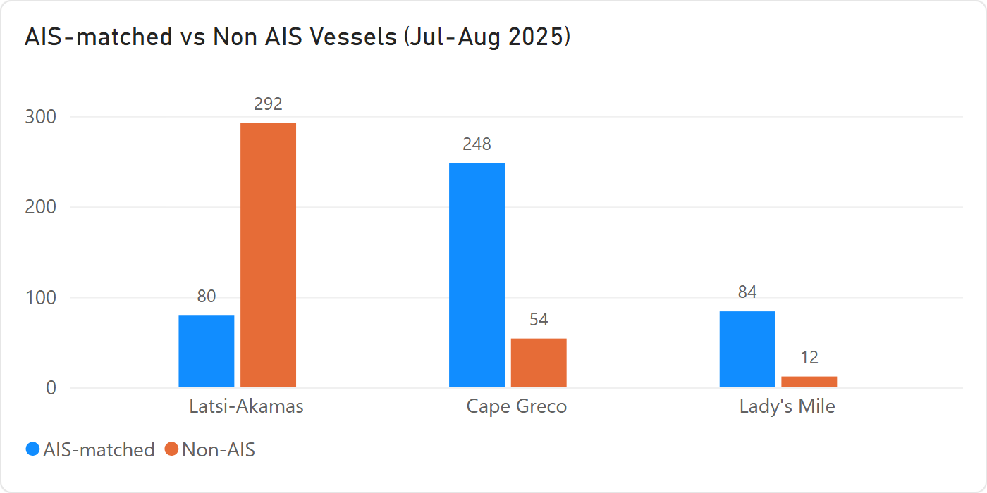
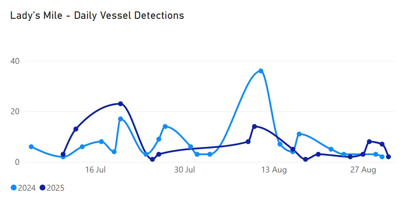
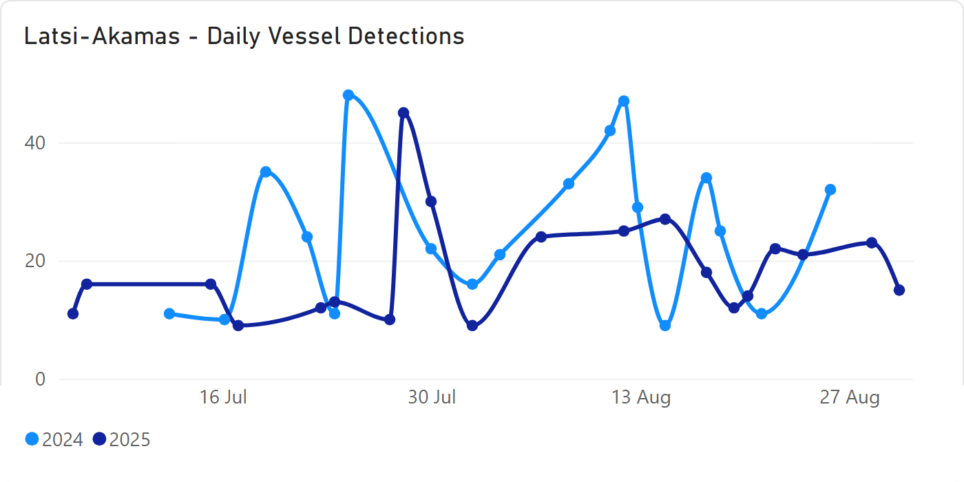
Across the three MPAs, detections during July–August were around 17% lower in 2025 than in 2024, with the largest decrease at Lady’s Mile, while activity at Cavo Greco remained broadly similar. Within the summer season, lower activity was observed in June, increasing in July and August when differences in the number of satellite observation days are taken into account. Overall, August showed the highest level of vessel activity in both years.
Comparing the same period across the two years, observed activity decreased at Latsi-Akamas and Lady’s Mile in 2025, while Cavo Greco remained broadly stable.
Importantly, around 60% of sampled vessel detections were classified as non-moving at the moment they were observed. While this does not necessarily mean that vessels were anchored for long periods, it identifies locations that may warrant closer attention. That is particularly relevant for the Posidonia seagrass. Anchors and chains can physically damage Posidonia meadows when repeatedly dropped or dragged across the seabed, and recreational boats can contribute to that pressure.
Combining maps of vessel activity with maps of Posidonia can highlight places where vessel pressure and sensitive seabed habitats may intersect. The heatmaps below show where detections are most concentrated across the three areas.
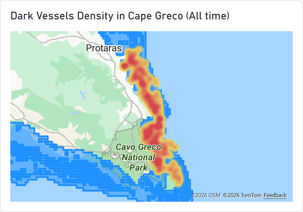
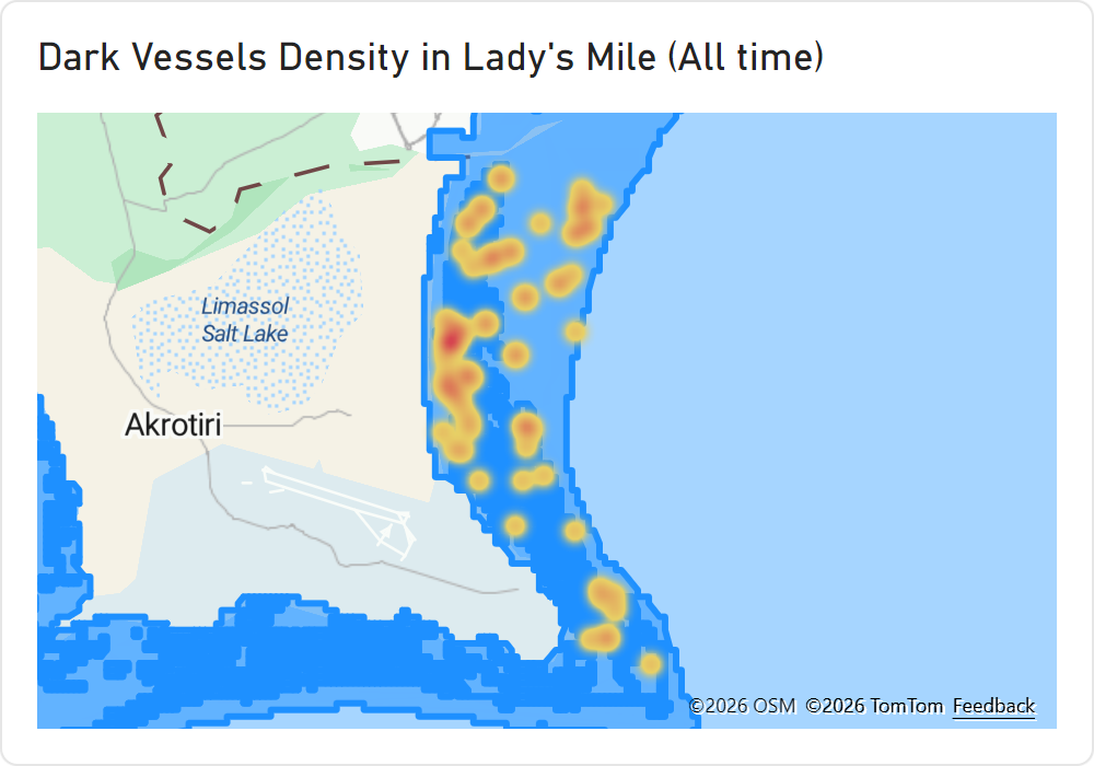
The findings demonstrate how satellite technology, together with AI, can be used for daily monitoring of Cyprus’s sensitive marine areas, so that changing hotspots and persistent visibility gaps can be recognised over time. Satellite technology would not replace patrols or existing vessel-tracking systems. It can complement them with an independent layer of information, helping authorities and conservation organisations focus attention where it is most needed.
These insights can provide policymakers and environmental authorities with clear, evidence-based information of the scale and distribution of vessel activity within sensitive MPAs. By making otherwise hard-to-observe disturbances visible and measurable, the research highlights the pressures on protected habitats such as Posidonia oceanica and support more informed decisions on monitoring, enforcement and management measures. The evidence can also strengthen the case for timely action to ensure that the designation of MPAs translates into effective protection and long-term conservation outcomes.
Marine protection depends not only on drawing boundaries, but on understanding what is happening within them. Satellite observations can give authorities an independent view of vessel activity and help direct monitoring towards the places where pressure or visibility gaps are greatest.